



Join thousands of fellow campervan travellers
Sign up for our Britz newsletter to receive inspirational travel content and awesome deals, and we'll send you a copy of our Ultimate RV guide!
Thanks
Please confirm subscription in your email.
Why do people go to the Rob Roy Glacier Track?
This is the hike many travellers choose when they want big mountain drama without committing to a multi-day mission. The track threads from river flats into a glaciated valley where steep rock walls rise to the blue ice of Rob Roy Glacier. Along the way, you pass mossy beech forest, hear birdsong, and watch crystal cascades plummet down cliffs fed by glacier melt.
The finale is a wide lookout basin that frames the glacier itself, complete with seracs, crevasses, and frequent icefall that booms across the valley. It is highly photogenic from the main viewpoints, and you do not have to be an expert tramper to reach it.
Families and casual hikers love Rob Roy because it balances effort and reward. The gradients are steady rather than punishing, the path is well formed, and older children with a bit of stamina usually manage it fine.
For keen photographers, the shifting clouds and changing light on the ice keep the scene dynamic. Nature lovers seek out native forest, waterfalls that multiply after rain, and the chance to spot cheeky alpine parrots near the upper lookout. All of this sits in a national park recognised for its outstanding natural beauty, so every step earns its place on many South Island itineraries.
Track highlights and what to expect
The adventure begins at Raspberry Creek car park at the road end of the West Matukituki Valley. A gentle warm-up leads to a swing bridge across the West Matukituki River, where glacier‑fed water flows beneath your feet. From here, the track climbs into beech forest draped in lichens and ferns. You will glimpse Rob Roy Stream tumbling alongside you, with short side views to small waterfalls. The canopy keeps things cool on summer days, and birds like fantails and tomtits often flit across the path.
As you rise above the treeline, the valley opens, and the soundtrack shifts to wind, water, and the distant crack of shifting ice. The upper basin is the star turn. Waterfalls ribbon down the cliffs, and the hanging glacier clings to Mount Rob Roy. On calm days, you can picnic on boulders and watch for kea patrolling the skyline. The viewpoint is spacious, which helps spread people out and makes it easy to soak up the scale of the landscape.
How long should I spend at the Rob Roy Glacier Track?
The track is about 10 kilometres return and typically takes 3 to 4 hours of walking for most visitors. That allows time for a steady climb, a relaxed break at the upper lookout, and plenty of photo stops. Add the scenic drive from Wānaka, which is about 1 hour 20 minutes each way in fine conditions, and you have a substantial half-day to most-of-a-day outing. If you pack a picnic and linger in the upper basin, plan on roughly 5.5 to 6.5 hours door to door.
If your schedule is tight or you are visiting in winter when avalanche risk is a factor, you can still enjoy a shorter walk to the lower lookout. That takes around 45 to 60 minutes each way and offers excellent river and forest scenery with first glimpses of the valley walls. Either way, start early for a quieter track and easier parking, or aim for late afternoon when the light can be soft on the glacier.
How to get to the Rob Roy Glacier Track
The track starts at Raspberry Creek car park at the end of the Wānaka–Mount Aspiring Road, about 54 kilometres from Wānaka. The sealed road traces Lake Wānaka’s edge to Glendhu Bay and remains sealed till the Treble Cone turnoff. The final 30 kilometres into the Matukituki Valley are unsealed, and the last stretch includes several shallow fords.
In fine weather, the drive is straightforward in a campervan if you go slowly and keep an eye on oncoming traffic. After heavy rain, creeks can rise, and the road can become impassable, so always check conditions before you set out.
From the car park, the track is well signposted. You will cross the river by swing bridge after about 15 minutes, then follow a steady climb through the forest to the upper basin. If you prefer not to drive gravel, seasonal shuttle services operate from Wānaka to Raspberry Creek.
When driving your campervan, keep speeds low on corrugations, give way where the road narrows, and avoid driving through fast-flowing water. The journey up the valley is a highlight in itself, with working farms, braided river views, and snow-capped peaks guiding you to the trailhead.
Best time to visit the Rob Roy Glacier Track
Late spring through autumn suits most visitors. From October to April, days are longer, and temperatures are milder, though shaded sections can still be slippery or icy in early spring or after cold snaps. Summer brings lush forest shade and often good picnic weather, but conditions can change quickly. Spring and early summer add extra punch to the waterfalls and a dusting of new snow on the peaks for striking photos. Autumn can be crisp and calm with fewer people on the path, which suits those who prefer a quieter experience.
In winter and early spring, avalanches can affect the upper valley even when there is little or no snow on the track itself. During this period, it is safest to limit your walk to the lower lookout unless you have the right skills, equipment, and conditions. No matter the month, start with a flexible plan. If rain has recently fallen, the fords on the access road may be high, and the track can be slippery in places. A morning start gives you more light and time to adjust plans if conditions change.
Weather in the Rob Roy Glacier Track region
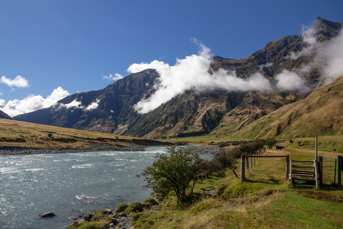
The Rob Roy valley sits on the doorstep of the Southern Alps, so the weather can turn quickly. Even in midsummer, a sunny start can shift to cool winds and showers at the upper lookout. Expect valley temperatures in the mid-teens to low twenties Celsius in summer, with cooler air as you climb. In winter, frosts are common and wind chill makes the upper basin feel significantly colder than the Raspberry Creek car park.
Pack layers you can add and remove easily, including a warm mid-layer and a waterproof jacket. Sturdy footwear with good grip helps on roots and damp rock. The sun is strong in Otago, so bring a hat, sunglasses, and sunscreen. Carry water and snacks because there are no shops and no potable water provided at the trailhead. Sandflies can be active near the river on still days, so insect repellent is useful. Mobile coverage is patchy to non‑existent in the valley, which is another good reason to tell someone your plans before you go.
Best place to park your campervan near the Rob Roy Glacier Track
Raspberry Creek car park is large and mostly flat, with areas suitable for campervans in fine conditions. Facilities are basic, with long-drop toilets and an information board. There are no powered sites, no potable water taps, and no bins, so come prepared to pack out all rubbish. Arrive early on summer days, especially during school holidays, to secure an easy park and to enjoy a quieter track.
If you want to spend the night close to the action, self-contained campervans are permitted to overnight at Raspberry Creek when local signage allows. Follow any instructions on the site, observe fire restrictions, and leave no trace so the area stays beautiful for everyone. Many travellers base themselves in Wānaka instead, where holiday parks and campgrounds offer powered sites, hot showers, and easy access to shops and cafés. A Britz campervan makes this simple, letting you choose a comfortable holiday park base or a self-contained night near the trailhead when conditions and rules allow.
What to know before you go
No booking is required for this day walk. Dogs are not permitted because the track sits within a national park that protects sensitive native wildlife. The path is well formed but includes steeper sections, tree roots, and places with steep drop-offs, so keep children close and stay on the marked route. Use the swing bridge to cross the river and never attempt to ford the West Matukituki on foot.
Avalanche paths cross the upper valley during colder months. If there is any chance of instability on surrounding slopes, do not continue beyond the lower lookout. After rain, the gravel access road may have deeper fords and soft shoulders, which can be challenging for heavier vehicles. If in doubt, wait for levels to drop or take a shuttle from Wānaka. Bring everything you need for a comfortable day out, including warm layers, food, and plenty of water. The payoff is a world‑class alpine amphitheatre on a well-formed half‑day walk. If you are travelling from Wānaka, allow most of a day to include driving, photo stops, and time to linger.
Rob Roy is the kind of walk that reminds you why you chose the open road. Pick up your Britz campervan from Queenstown, point it up the Matukituki Valley, and let the mountains do the rest. With glacier views, lush forest, and an easy‑to‑follow trail, it is a highlight for many South Island itineraries.
FAQs and quick answers
-
How long does it take to hike Rob Roy?
The full Rob Roy Glacier Track usually takes around 3 to 4 hours return. If you include the drive from Wānaka and time for breaks and photos, allow most of a day. -
Where is the Rob Roy Track?
The Rob Roy Glacier Track is in Mount Aspiring National Park, in the Matukituki Valley near Wānaka in New Zealand’s South Island. It starts from the Raspberry Creek car park. -
What is the hardest track in NZ?
There is no single official hardest track in New Zealand, as it depends on distance, elevation, terrain and weather. Serious alpine routes and remote backcountry tramps are generally much harder than popular day walks like Rob Roy. -
How hard is Roys Peak walk?
Roys Peak is considered more challenging than Rob Roy. It is a longer, steeper climb with a sustained uphill section, while Rob Roy is shorter, more sheltered, and generally more manageable for casual hikers with a reasonable level of fitness.
Road trips that pass through
Britz Southern Explore road trip
Northbound Scenic Sights Itinerary